UK Crash Map: Explore the UK's Road Safety Landscape
Unlock access to comprehensive UK road accident data. Visualize historical crashes, filter by location, time, and conditions, and gain insights that drive safer roads, smarter city planning, and impactful research.
Who is ukcrashmap for?
Whether you’re a curious member of the public, a researcher, or a policymaker, ukcrashmap makes it easy to explore and analyze UK crash data like never before. Our interactive maps provide fine-grained filters, helping you uncover patterns, hotspots, and trends that can inform better road safety decisions.
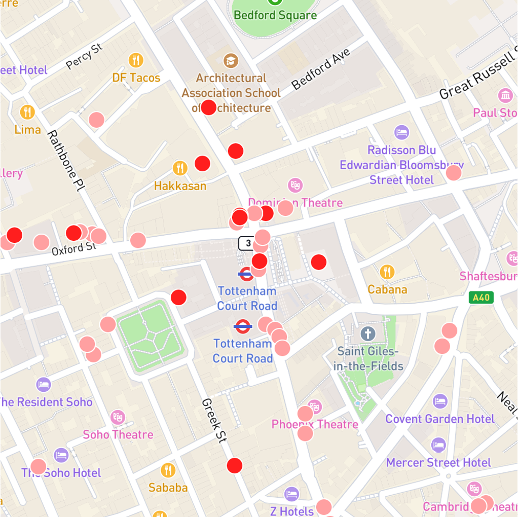
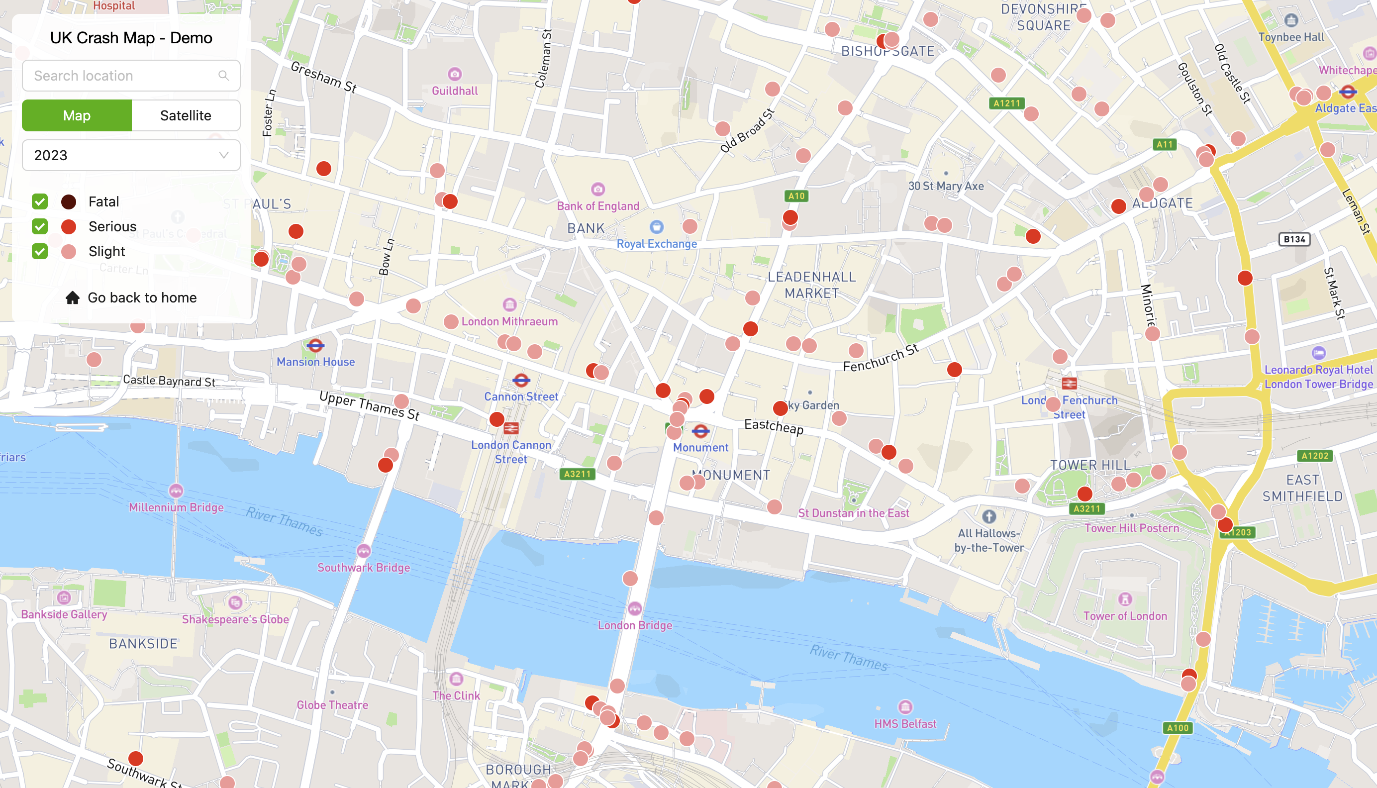
Visualization
See the data come alive. Every crash is plotted directly on a map, giving you an instant visual overview of accident hotspots, trends, and distributions across the UK.
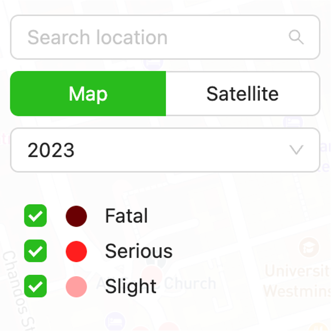
Filter
Apply fine-grained filters to explore crash data by year, severity, weather, road type, time of day, and more. Focus only on the data that matters to your research or analysis.
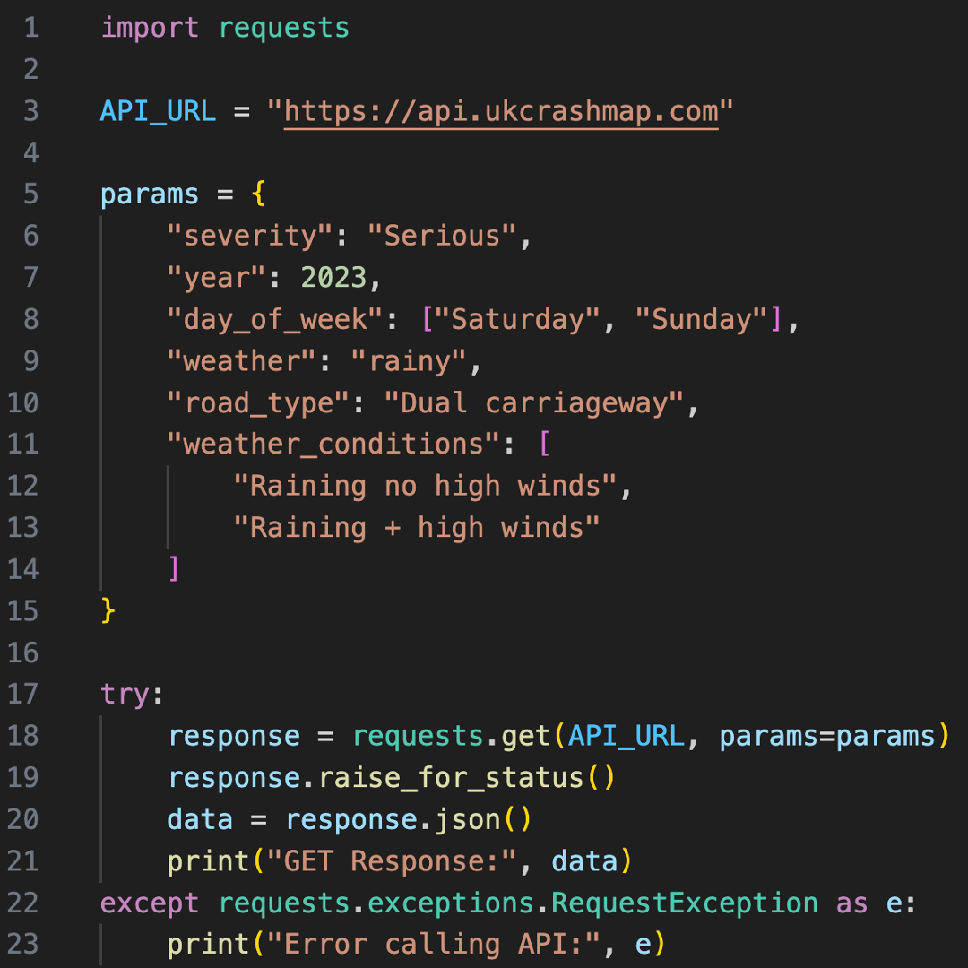
API
Access accident data programmatically with our API. Apply the same filters and retrieve exactly the dataset you need, ready for analysis, reporting, or integration with your workflows.
Partnerships & Investment
ukcrashmap is currently in development. We are seeking partnerships and investment to expand our capabilities and impact, bringing detailed UK road safety insights to more users and decision-makers.